Santorini / The Island
Santorini island Geography
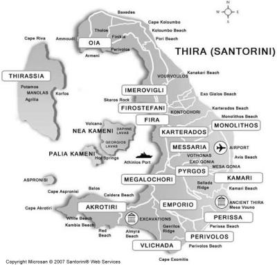
- Santorini is a group of islands in the south Aegean sea: Thira, Thirassia, Aspronisi, the Christiana Islands, Palia Kameni (Hot Springs) and Nea Kameni (Volcano).
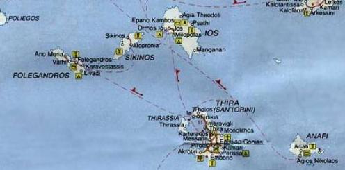
- The Province of Thera (Thira) is made up of Santorini, Anafi, Thirassia, Ios, Folegandros and Sikinos - the Southern Cyclades group.
- Thira island is approximately 73 sq. kilometers in size (28 sq. miles)
Population
- Permanent residents : 17,752 (2011 census)
Distance to Santorini
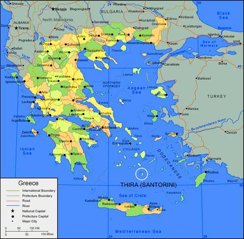
- 128 nautical miles from Piraeus port (port of Athens) on the mainland and 63 nautical miles north of Crete.
- 40 min. by airplane from Eletherios Venizelos (Athens)
Geographical Coordinates
- Latitude :36 19’ 56” to 36 28’ 40” N.
- Longitude :25 19’ 22” to 25 29’ 13” E

MAP OF SANTORINI ISLAND

MAP OF GREECE SHOWING SANTORINI ISLAND

SOUTHERN CYCLADES GROUP OF ISLANDS
